


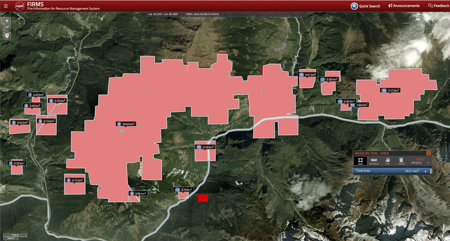
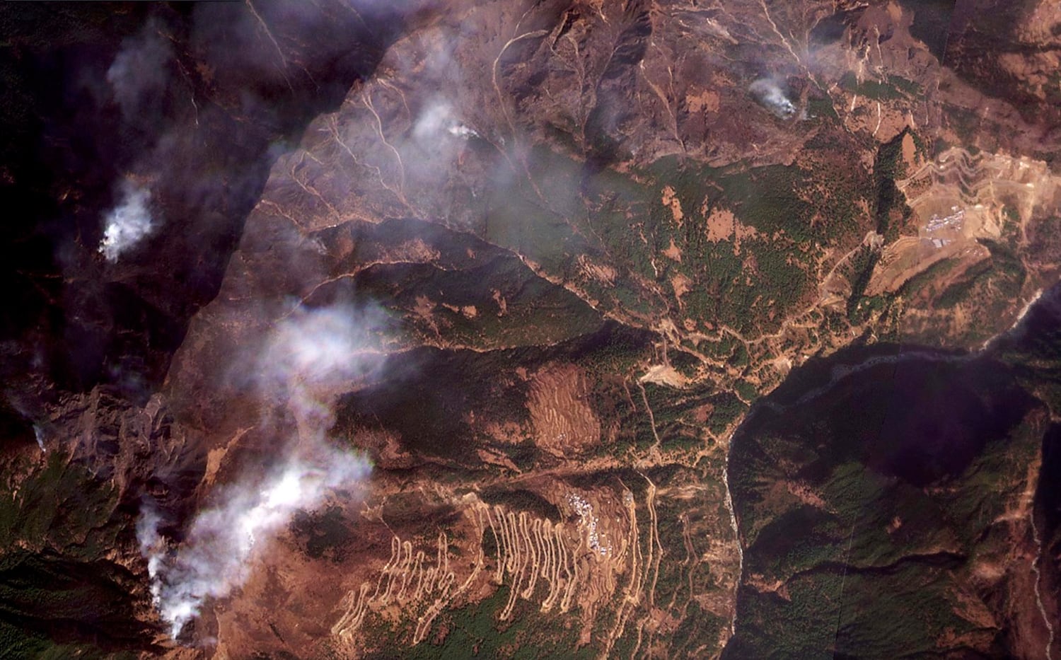
Four forest fires have erupted in various parts of Tibet over the past two weeks, with a major one in Kyirong county near the border with Nepal raging uncontained after it swept through 40 square kilometers (15 square miles), according to satellite images and sources with knowledge of the situation.
Chinese state media has provided only general reports, with no casualty figures. Tibetan sources told Radio Free Asia that Chinese authorities have restricted local residents from sharing details about the disasters on social media.
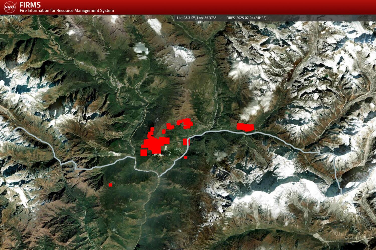
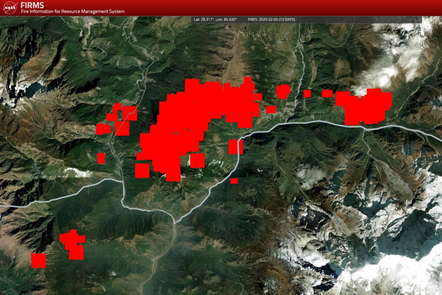
The largest fire, which broke out Jan. 23, was burning in a heavily forested area of Kyirong county in Shigatse prefecture of the Tibet Autonomous Region, or TAR, according to the sources, satellite images and a map from the NASA FIRMS, or Fire Information for Resource Management System.
The region supports a diverse range of wildlife, including long-tailed gray leaf monkeys, leopards, musk deer, elk, peacock pheasants, snow chickens and herds of wild donkeys.
It is also home to over 100 tree species, including rare varieties such as Tibetan longleaf pine, longleaf spruce and Himalayan yew.
The region also contains over 200 types of herbal medicines, such as cordyceps, Panax notoginseng and gastrodia elata, many of which are considered nationally valuable.
Another fire was raging in Gangri township of Bachen, or Bagen in Chinese, in the TAR.
Two other wildfires have been reported in Sichuan province, to the east — one near Ringpo village in Nyagchuka (Yajiang) county that started on Feb. 2 and another near Gamda village in Zamthang (Rangtang) county in Aba Prefecture on Feb. 5.
Local Chinese officials said the cause of the fires was unknown and under investigation.
Few firefighters dispatched
The fires have continued to spread after two weeks because Chinese authorities dispatched only a few firefighters, according to the source outside Tibet but in contact with residents on the ground.
“Chinese authorities have dispatched only a few firefighters so that the fire was not contained, even over 10 days after it first broke out,” the person said.
Known for its rich vegetation and biodiversity, Kyirong county comprises over 143,000 hectares (353,400 acres), including 128,000 hectares (317,000 acres) of forest land that fall under the Qomolangma National Natural Preserve, according to the Jilong County Forestry and Grassland Bureau. Qomolangma is the local, original name for Mount Everest.
On Jan. 24, authorities initiated a Level 4 emergency response — the lowest on China’s four-tier system — at 2 p.m., according an announcement by the county bureau’s Emergency Plan.
Satellite imagery of the fire shows it started near Sale (Seqiong) village in Kyirong county close to Tibet’s border with Nepal, and has since spread across more than 17 kilometers (11 miles), and is now blazing in forests close to Kyirong town.

In Gangri township of Bachen County in Nagqu in the TAR, one Tibetan netizen wrote on Chinese social media on Wednesday: “Even though it has been days since the first fire outbreak, there’s no help in extinguishing the fire. Who’s going to save us?”
Past wildfires
Wildfires have erupted in Sichuan’s Nyagchu county before.
In December 2024, a blaze broke out on the mountains near Chuka town that took a week to put out. Another fire in March of that year resulted in significant property damage.
Located in the hilly plateau area of northwest Sichuan, Nyagchuka county boasts a diverse and rich biodiversity due to its varied topography and climate. It is home to 196 species of large fungi, including 126 edible varieties, as well as an abundance of medicinal plants such as cordyceps, astragalus and fritillaria.
The forest fire in Zamthang county, which occurred around 4 p.m. local time on Thursday, reportedly threatened several surrounding villages as it spread.
The Sichuan Provincial Forest Fire Brigade dispatched 495 people and 93 vehicles to the fire scene, official state media said.
Additional reporting by Dolma Lhamo, Tsering Namgyal, Tenzin Norzom and Tashi Wangchuk. Edited by Tenzin Pema for RFA Tibetan, and by Roseanne Gerin and Malcolm Foster.